
Aurora (province)
Aurora | |
|---|---|
| Province of Aurora | |
    (from top: left to right) Cuaresma beach in Casiguran, Dicasalarin Cove in Baler, Dinadiawan Beach in Dipaculao, Ditawini beach in Dinalungan | |
 Flag  Seal | |
 Location in the Philippines | |
OpenStreetMap  | |
| Coordinates: 15°53′N 121°33′E / 15.88°N 121.55°E | |
| Country | Philippines |
| Region | Central Luzon |
| Founded | 1951 (as sub-province of Quezon) |
| Province | 13 August 1979 |
| Named for | Aurora Quezon |
| Capital | Baler |
| Largest Municipality | Maria Aurora |
| Government | |
| • Governor | Reynante A. Tolentino (LDP) |
| • Vice Governor | Jennifer A. Araña (PFP) |
| • Legislature | Aurora Provincial Board |
| Area | |
| • Total | 3,147.32 km2 (1,215.19 sq mi) |
| • Rank | 42nd out of 81 |
| Highest elevation | 1,901 m (6,237 ft) |
| Population (2020 census)[2] | |
| • Total | 235,750 |
| • Rank | 70th out of 81 |
| • Density | 75/km2 (190/sq mi) |
| • Rank | 77th out of 81 |
| Demonym(s) | Auroran, Auroreño |
| Divisions | |
| • Independent cities | 0 |
| • Component cities | 0 |
| • Municipalities | |
| • Barangays | 151 |
| • Districts | Legislative district of Aurora |
| Demographics | |
| • Ethnic groups |
|
| • Languages | |
| Time zone | UTC+8 (PST) |
| ZIP code | 3200–3207 |
| IDD : area code | +63 (0)42 |
| ISO 3166 code | PH-AUR |
| Website | www |
Aurora, officially the Province of Aurora (Filipino: Lalawigan ng Aurora; Ilocano: Probinsia ti Aurora), is a province in the Philippines located in the eastern part of Central Luzon region, facing the Philippine Sea. Its capital is Baler and borders, clockwise from the south, the provinces of Quezon, Bulacan, Nueva Ecija, Nueva Vizcaya, Quirino, and Isabela.
Before 1979, Aurora was part of the province of Quezon. Aurora was, in fact, named after Aurora Aragon, the wife of Manuel L. Quezon, the president of the Philippine Commonwealth, after whom the mother province was named.
History[edit]
_from_%22Under_the_red_and_gold%22.jpg)
Spanish colonial era[edit]
In 1572, the Spanish explorer Juan de Salcedo became the first European to visit the region that would be known as Aurora while he was exploring the northern coast of Luzon. Salcedo reportedly visited the towns of Casiguran, Baler and Infanta. Baler & Casiguran were part of La Provincia de La Pampanga, which also included Pampanga, Bulacan, and Tarlac, and in 1591, the towns became part of Kalilayan, which included Nueva Ecija, until Kalilayan changed its name to Tayabas in 1749, taken from the town of the same name.[3][4][5][6]
In the early days of the Spanish colonial period, Aurora was ecclesiastically linked to Infanta, which today rests further south, in northern Quezon. The earliest missionaries in the province were the Franciscans, who had established missions in Baler and Casiguran in 1609.[7] Due to lack of available personnel, the region was given to the jurisdiction of the Augustinians and Recollects in 1658, but was returned to the Friars Minor in 1703. Other early missions included Dipaculao, established in 1719, and Casiguran, in 1753.
In 1705, the Military Comandancia of Nueva Ecija was created and was governed by Governor-General Fausto Cruzat y Góngora. It included huge swathes of Central Luzon, the Contracosta towns, as well as the Kalilayan area and Polillo Islands, however Nueva Ecija was still part of La Pampanga province at that time.[8][5] Contracosta was the Spanish colonial name for the towns on the east coast and included towns from Mauban, Binangonan de Lampon, to El Principe.[9][6] Since Contracosta & Kalilayan were part of La Laguna province at that time before including them in Nueva Ecija, they became jointly ruled by La Pampanga & La Laguna provinces.[4] Contracosta and Tayabas area became jointly ruled by Tayabas and Pampanga when Tayabas became independent from La Laguna in 1754. When Rafael María de Aguilar y Ponce de León took over as Governor-General of the Philippines, he decreed the separation of the military- district of Nueva Ecija from the province of Pampanga and became a regular province on April 25, 1801, including the town of Baler, acquired from Tayabas.[3]
In 1818, Nueva Ecija annexed the towns of Palanan from Isabela, as well as Baler, Casiguran, Infanta (formerly called Binangonan de Lampon) and Polillo Islands from Tayabas.[4] In 1853, the new military district of Tayabas was separated from Nueva Ecija and included present-day Southern Quezon as well as present-day Aurora. In 1858, Binangonan de Lampon and the Polillo Islands were separated from Nueva Ecija to form part of Infanta.[8] Between 1855 and 1885, El Principe was established as its own Military Comandancia with its capital in Baler.[4]
American invasion era[edit]

District of El Principe[edit]
The early history of Aurora is linked to Quezon province, of which it formed a part, and Nueva Ecija, under which the area was governed as the District of El Príncipe. In 1902, the district was separated from Nueva Ecija and transferred to the province of Tayabas (now Quezon).[7][10] The northern area which is part of the modern Dilasag and area of modern Casiguran was part of Nueva Vizcaya and also transferred to Tayabas in 1905.[11] In 1918, the area of modern Aurora north of Baler was transferred to the authority of Nueva Vizcaya, but returned to Tayabas in 1946, when Tayabas was renamed to Quezon.
World War II[edit]
In 1942, invading Japanese forces landed in the town of Casiguran. On February 19, 1945 to May 11, 1945, Allied troops as well as Philippine Commonwealth forces and recognized guerrilla units fought on the Battle of Casiguran during the return of American forces on Luzon on World War II.[citation needed]
Postwar era[edit]
During the postwar years, there were several attempts to make Aurora independent from the rest of Quezon Province. One obvious reason was the area's isolation from the rest of Quezon Province: there were no direct links to the rest of the province and much of the terrain was mountainous and heavily forested, which made the area relatively isolated.[citation needed] Independence from Quezon also meant that Aurora would belong in the Central Luzon region, in keeping with its precolonial history, rather than part of Southern Luzon.[12]
Aurora became a sub-province of Quezon in 1951 through Republic Act No. 648 under the presidency of Elpidio Quirino, after whom its neighboring province was named.[13]
In 1978, the Lieutenant Governor of the Sub-Province Atty. Luis S. Etcubaez filed a Parliamentary Bill for the establishment of Aurora at the Interim Batasang Pambansa, leveraging his political ties with with the various Assemblymen of Region IV.[14] This led to a plebiscite in May 1979 to confirm the citizens of the Province's willingness to separate from Quezon Province, and the eventual establishment of the province through Batas Pambansa Blg. 7 on November 21, 1978.[7][15]
1968 Casiguran earthquake[edit]
On 04:19:22 local time on August 2, the 1968 Casiguran earthquake, with a moment magnitude of 7.6 and a maximum Mercalli intensity of IX (Violent), took place with an epicenter was in Casiguran. The quake generated a small non-destructive tsunami was generated, but the majority of the 207 people killed during the quake were the result of the collapse of a six-story building in Manila.
During the Marcos dictatorship[edit]
The beginning months of the 1970s had marked a period of turmoil and change in the Philippines, as well as in Aurora.[16][17] During his bid to be the first Philippine president to be re-elected for a second term, Ferdinand Marcos launched an unprecedented number of foreign debt-funded public works projects. This caused[18][19] the Philippine economy took a sudden downwards turn known as the 1969 Philippine balance of payments crisis, which in turn led to a period of economic difficulty and a significant rise of social unrest.[20][21][22][23] : "43"
With only a year left in his last constitutionally allowed term as president Ferdinand Marcos placed the Philippines under Martial Law in September 1972 and thus retained the position for fourteen more years.[24] This period in Philippine history is remembered for the Marcos administration's record of human rights abuses,[25][26] particularly targeting political opponents, student activists, journalists, religious workers, farmers, and others who fought against the Marcos dictatorship.[27]
One significant impact on the residents of Aurora, especially its farmers, was the administration's practice of hamletting to achieve military control of the area.[28] After the September 1972 declaration, Marcos forces were ordered into the province to achieve a military presence. But the New People's Army (NPA) which was fighting them responded by establishing a presence of their own in Aurora's mountainous areas. Despite the fact that the residents generally resisted invitations to join the NPA,[28] the dictatorship troops told the residents that they were not allowed into the fields between Four in the afternoon and Seven in the morning. This made farming very difficult because people had to work in the fields during the hottest parts of the day.[28]
Things took a more violent turn in the town Dinalungan during the early 1980s, after farmers organized a rally against against a landowner who attempted to claim their farms, seeking help and support from the nuns at the Carmelite mission which had been established there.[28] However, the military accused the Carmelites of working with the NPA, and even hunted down the convent's caretaker and one of the church workers.[28] Young men started disappearing from the farms,[28] and rumors begun to spread that they had been victims of extrajudicial killings by Marcos' forces.[28] Much of the male population of Dinalungan began to disappear altogether, with some believed to be victims of the extrajudicial killings, and the rest forced to join the NPA because of the circumstances.[28] The unrest persisted until the town was finally declared "insurgency free" in October 2018.[29]
Birth of the Surf tourism industry[edit]

One of the positive things that did happen to Aurora during the 1970s was the development of the Surf tourism industry after the helicopter attack and surfing sequences of the film Apocalypse Now were filmed at Baler in 1976-77. The exposure of locals to the art of surfing during the production of the movie is credited with having sparked the surfing culture in Aurora and the Philippines.[30]
Administrative assignment[edit]
Being originally part of the province of Quezon, Aurora was part of the Southern Tagalog Region (Region IV). Upon the issuance of Executive Order No. 103, dated May 17, 2002, by then-President Gloria Macapagal-Arroyo, the province of Aurora was moved to Central Luzon (Region III), the geographical location of the province. The provinces south of Aurora were reformed as Calabarzon and Mimaropa, and Southern Tagalog was limited to being a cultural-geographic region. The total separation of Aurora from Quezon, and the transfer of Aurora to Central Luzon were the fulfillment of the wishes and prayers of the residents of the original Municipalities of Baler and Casiguran to be truly independent from Quezon Province for the first time and to reform the original La Pampanga since the Spanish occupation.[4][31]
Contemporary[edit]
On April 22, 2024, newly installed Governor Reynante A. Tolentino took his oath of office as governor before his brother, Dipaculao Mayor Danilo A. Tolentino. He replaced Atty. Christian Noveras, who was dismissed by the Office of the Ombudsman along with his father, Vice Governor Gerardo Noveras, in December, 2023.[32]
Geography[edit]
Aurora is a coastal province covering an area of 3,147.32 square kilometres (1,215.19 sq mi)[33] in east-central Luzon. To the north, it is bordered by the Northern Sierra Madre Natural Park of Isabela, to the west by the central range of the Sierra Madre which contains the Casecnan Protected Landscape and Aurora Memorial National Park, to the south by the Umiray River, and to the east by the Philippine Sea which opens to the Pacific Ocean. The San Ildefonso Peninsula lies in the province's northern portion between the Philippine Sea and the Casiguran Sound.
Topography[edit]
The province covers a portion of the Sierra Madre mountain range. As such, the elevation is generally steep to very steep and only about 14% of the province's total area is flat.[7]
Climate[edit]
Aurora's climate is classified as Tropical rainforest climate.[34] It experiences significant rainfall throughout the year.[34] Because the coastal province faces the Pacific Ocean, it is frequently visited by typhoons.[7][35]
Administrative divisions[edit]

Aurora is politically subdivided into 8 municipalities, all encompassed by a lone legislative district.
Dilasag and Casiguran form the northern part of the province, while Dinalungan, Dipaculao, Maria Aurora, and Baler (the capital) make up the central portion. The southern half of the province consists of San Luis and Dingalan.
| Municipality [i] | Population | ±% p.a. | Area[33] | Density | Barangay | |||||||
|---|---|---|---|---|---|---|---|---|---|---|---|---|
| (2020)[2] | (2015)[36] | km2 | sq mi | /km2 | /sq mi | |||||||
| 15°45′34″N 121°33′46″E / 15.7595°N 121.5627°E | Baler | † | 18.6% | 43,785 | 39,562 | +1.95% | 92.54 | 35.73 | 470 | 1,200 | 13 | |
| 16°12′15″N 122°02′24″E / 16.2041°N 122.0400°E | Casiguran | 11.3% | 26,564 | 24,313 | +1.70% | 715.43 | 276.23 | 37 | 96 | 24 | ||
| 16°23′23″N 122°12′36″E / 16.3898°N 122.2099°E | Dilasag | 7.3% | 17,102 | 15,835 | +1.48% | 306.25 | 118.24 | 56 | 150 | 11 | ||
| 16°08′30″N 121°57′22″E / 16.1416°N 121.9560°E | Dinalungan | 5.3% | 12,508 | 11,322 | +1.91% | 316.85 | 122.34 | 39 | 100 | 9 | ||
| 15°23′22″N 121°23′34″E / 15.3894°N 121.3927°E | Dingalan | 11.8% | 27,878 | 25,482 | +1.73% | 304.55 | 117.59 | 92 | 240 | 11 | ||
| 15°50′52″N 121°32′12″E / 15.8477°N 121.5367°E | Dipaculao | 14.1% | 33,131 | 29,736 | +2.08% | 361.64 | 139.63 | 92 | 240 | 25 | ||
| 15°47′54″N 121°28′20″E / 15.7982°N 121.4723°E | Maria Aurora | 19.1% | 44,958 | 40,734 | +1.90% | 426.29 | 164.59 | 110 | 280 | 40 | ||
| 15°43′09″N 121°31′04″E / 15.7191°N 121.5178°E | San Luis | 12.7% | 29,824 | 27,352 | +1.66% | 609.85 | 235.46 | 49 | 130 | 18 | ||
| Total | 235,750 | 214,336 | +1.83% | 3,133.40 | 1,209.81 | 75 | 190 | 151 | ||||
| † Provincial capital | Municipality | |||||||||||
| ||||||||||||
Barangays[edit]
The 8 municipalities of the province comprise a total of 151 barangays, with Suclayin in Baler as the most populous in 2010, and Dibalo in San Luis as the least.[37]
Demographics[edit]
|
|
| ||||||||||||||||||||||||||||||||||||||||||||||||||||||
| Source: Philippine Statistics Authority[36][37][37] | ||||||||||||||||||||||||||||||||||||||||||||||||||||||||
The population of Aurora in the 2020 census was 235,750 people,[2] with a density of 75 inhabitants per square kilometre or 190 inhabitants per square mile.
Based on the 2000 census survey, Tagalogs comprised 52.85% (91,745) of the total provincial population of 173,589, and about less than 1/3 of the population were Ilocano at 31.43% (54,557). Other ethnic groups in the province were Kasiguranin at 5.1% (8,853), Bicolano at 4.08% (7,079), Kankanaey at 1.36% (2,355), Bisaya at 0.88% (1,529), Dumagat (Umiray) at 0.6% (1,047), and Cebuano at 0.48% (832).[38]
There are also pockets of Bugkalots & Negritos, called Dumagats. Most Dumagats are living in the hillsides or mountains. They are believed to have result from a fusion of Austronesian and Melanesian ancestries, and survive from fishing and hunting. There are three kinds of Dumagats in Aurora province, the Umiray Dumagat, Casiguran Dumagat, and the Palanan Dumagat. Bugkalots are the second tribe indigenous to Aurora, most of them live in Dipaculao & Maria Aurora.
Tagalogs, some originating from Palanan and Infanta, Quezon, came in to the area to trade by boat, some Tagalogs settled in Aurora (especially Baler) and married with the Aeta and Bugkalots.[39] The Spanish brought in Filipino acolytes from other areas of Luzon from 1609 to 1899. During this period, Baler can only be access by sea though the town saw increase migration from other parts of Luzon such as Laguna, Tayabas, and Bicol from the south. The opening of the Baler-Bongabon Road allowed easier migration of people from Ilocos and Isabela areas from the north. The road also allowed Igorot people and Batangueño Tagalogs to settle in Baler & other places of Aurora. The majority of Igorots settled Dipaculao, Maria Aurora, & Baler. In 1896, a group of Ilocanos from Aringay, La Union came to settle in San Jose, now called Maria Aurora; in 1906, another group of Ilocanos arrived from La Union and Pangasinan. In the early 1920s, Ilocano settlers from Central Luzon settled a Bugkalot territory Dipaculao, which in turn was derived from the phrase Dipac naulaw or Naulaw ni Dipac, the Ilocano for "Dipac got dizzy", idiomatically "Dipac is/got drunk", Dipac is the name of a Bugkalot chief; another group of Ilocano settlers arrived from La Union, Pangasinan, and other areas of Ilocos Region. The guerrilla movement during the Japanese occupation brought Novo Ecijanos (people from Nueva Ecija) to Baler; Novo Ecijanos include Tagalogs, Ilocanos, and Kapampangans, with quite large number of Pangasinenses. The Balereños learned trade from the Batangueños and the Novo Ecijanos; where before they used to share what they have, now they would sell coconut to their neighbors.[39][40][41] Other ethnic groups who came and stayed in Aurora include Christianized Gaddang and Isinai settlers who settled the surrounding lowlands of Baler Bay.[42] These ethnic groups who lived for several centuries & left cultural influences & legacies made Aurora the melting pot of the Central Luzon, next to Tarlac & Nueva Ecija.
Languages[edit]
This section needs additional citations for verification. (April 2023) |
The Tagalog and Ilocano languages are spoken by their respective ethnic groups. The province primarily speaks a Tagalog dialect that is closely related to Tayabas Tagalog of Quezon with some Ilocano influences.[43][better source needed] In Baler, for example, the variety is called Tagalog-Baler (Balereño). The Balereño is also known for distinctive expressions like akkaw, used to express surprise, wonder, disgust, and objection; it is also akin to the English term "Wow!" Other regional term expressions spoken in Baler are are(h), used to express a negative feeling of surprise; anin, used to express regret or pity for a situation; and many other words are also spoken similarly to neighboring Quezon, like adyo, meaning to climb, and puropur, which pertain to rain with gusty wind. Ilocano is mostly spoken in northern areas of the province. The working population is ready in speech in the English language as well as in the Filipino language.[44][45][46][47] Manuel L. Quezon, who was from Baler, was called the Father of the National Language for approving the recommendation of the Institute of National Language for Tagalog as the basis of the national language. Other languages spoken in Aurora are Kapampangan & Pangasinan (in some areas of the province, most of which is in Baler), & another language native in Aurora is Casiguranin or Kasiguranin, spoken in Casiguran & neighboring areas Dilasag & Dinalungan.[48]
Religion[edit]
Catholicism[edit]

The people of Aurora are heavily Catholics (large majority being Roman Catholic by 87%)[citation needed] as a result of hundreds of years of Spanish colonization.
Others[edit]
Some other Christian believers are also present, which includes Members Church of God International (MCGI), Methodists, Aglipayan Church 2-3%, Baptists, Born Again Christians, Jehovah's Witnesses, Iglesia ni Cristo 4% and Seventh-day Adventist while Muslims are also found which presence is traced to migration by some people from some parts of Mindanao. Muslims, Anitists, animists, and atheists are also present in the province.
Economy[edit]
Corn, rice and other major agricultural crops are grown in Aurora, with a total of 13% of the provincial land area used for agriculture. It also has 8,945 hectares (22,100 acres) of rice plantation that averages 24,000 metric tons (24,000 long tons; 26,000 short tons) every year.[citation needed]
Aurora Pacific Economic Zone[edit]
Casiguran is home to the Aurora Pacific Economic Zone and Freeport Authority or APECO a special economic zone located in this coastal town. Created in 2007 by virtue of Republic Act No. 9490 through the efforts of Sen. Edgardo Angara and his son, Aurora Rep. Sonny Angara, it is expected be a major transshipment hub going to the Pacific region. It aims to boost social, economic and industrial developments in Aurora and nearby provinces by generating jobs for the people, improving the quality of their living conditions, advocating an eco-friendly approach to industrialization and enhancing the potential of the community in productivity.
Gallery[edit]
-
 Bulwagan ng Katarungan
(RTC), Suklayin, Baler -
 Aurora Police Provincial Office, NPC, PNP, Baler
 -
 Aurora Provincial Tourism Office (Suklayin)
 -

-
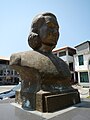 Bust of Maria Aurora


Notable people[edit]

- Sonny Angara, senator since 2013.
- Bellaflor Angara-Castillo, governor from 2004 to 2013.
- Manuel L. Quezon, first president of the Commonwealth of the Philippines
- Aurora Quezon, former first lady of the Philippines, wife of President Manuel L. Quezon
See also[edit]
References[edit]
- ^ "List of Provinces". PSGC Interactive. Makati, Philippines: National Statistical Coordination Board. Archived from the original on 19 April 2016. Retrieved 5 March 2020.
- ^ a b c Census of Population (2020). "Region III (Central Luzon)". Total Population by Province, City, Municipality and Barangay. Philippine Statistics Authority. Retrieved 8 July 2021.
- ^ a b The Brief History of Aurora
- ^ a b c d e "Aurora, Philippines – History". www.aurora.ph. Archived from the original on February 8, 2017. Retrieved February 7, 2017.
- ^ a b Baler During Spanish Occupation in Aurora.ph
- ^ a b "History of Quezon Province". Provincial Government of Quezon. Archived from the original on October 1, 2016. Retrieved April 4, 2016.
- ^ a b c d e Lancion, Conrado M. Jr. (1995). "The Provinces; Aurora". Fast Facts about Philippine Provinces. cartography by de Guzman, Rey (The 2000 Millenium ed.). Makati, Metro Manila, Philippines: Tahanan Books. p. 28. ISBN 971-630-037-9. Retrieved 4 December 2015.
- ^ a b Jose, Diocese of San. "Diocese of San Jose, Nueva Ecija – History". www.dioceseofsanjose.org. Archived from the original on February 8, 2017. Retrieved February 7, 2017.
- ^ "The Archdiocese | Archdiocese of Caceres". caceres-naga.org. Archived from the original on February 8, 2017. Retrieved February 7, 2017.
- ^ National Historical Commission of the Philippines. "History of Baler". National Historical Commission of the Philippines. Retrieved 2012-03-09.
When military district of El Príncipe was created in 1856, Baler became its capital...On June 12, 1902 a civil government was established, moving the district of El Príncipe away from the administrative jurisdiction of Nueva Ecija...and placing it under the jurisdiction of Tayabas Province.
- ^ The picture of territorial evolution of Quezon.

- ^ Tantingco: The Kapampangan in Us
- ^ Republic Act No. 648 (14 June 1951), An Act Creating the Subprovince of Aurora, Which Shall Comprise the Municipalities of Baler, Casiguran, Dipaculao and Maria Aurora, Province of Quezon, retrieved 8 December 2015
- ^ Provincial Government of Aurora. "Aurora, Philippines - History". Aurora.ph. Retrieved 2024-06-17.
- ^ Batas Pambansa Blg. 7 (21 November 1978), An Act Separating the Sub-province of Aurora from the Province of Quezon and Establishing It as an Independent Province, retrieved 8 December 2015
- ^ Robles, Raissa (2016). Marcos Martial Law: Never Again. Filipinos for a Better Philippines, Inc.
- ^ https://www.officialgazette.gov.ph/edsa/the-ph-protest/
- ^ Balbosa, Joven Zamoras (1992). "IMF Stabilization Program and Economic Growth: The Case of the Philippines" (PDF). Journal of Philippine Development. XIX (35). Archived from the original (PDF) on September 21, 2021. Retrieved November 6, 2022.
- ^ Balisacan, A. M.; Hill, Hal (2003). The Philippine Economy: Development, Policies, and Challenges. Oxford University Press. ISBN 9780195158984.
- ^ Cororaton, Cesar B. "Exchange Rate Movements in the Philippines". DPIDS Discussion Paper Series 97-05: 3, 19.
- ^ Celoza, Albert F. (1997). Ferdinand Marcos and the Philippines: The Political Economy of Authoritarianism. Greenwood Publishing Group. ISBN 9780275941376.
- ^ Schirmer, Daniel B. (1987). The Philippines reader : a history of colonialism, neocolonialism, dictatorship, and resistance (1st ed.). Boston: South End Press. ISBN 0896082768. OCLC 14214735.
- ^ Kessler, Richard J. (1989). Rebellion and repression in the Philippines. New Haven: Yale University Press. ISBN 0300044062. OCLC 19266663.
- ^ Magno, Alexander R., ed. (1998). "Democracy at the Crossroads". Kasaysayan, The Story of the Filipino People Volume 9:A Nation Reborn. Hong Kong: Asia Publishing Company Limited.
- ^ "Alfred McCoy, Dark Legacy: Human rights under the Marcos regime". Ateneo de Manila University. September 20, 1999.
- ^ Abinales, P.N.; Amoroso, Donna J. (2005). State and society in the Philippines. Lanham, MD: Rowman & Littlefield Publishers. ISBN 978-0742510234. OCLC 57452454.
- ^ "Gone too soon: 7 youth leaders killed under Martial Law". Rappler. Retrieved June 15, 2018.
- ^ a b c d e f g h Susan, Quimpo (2015-09-15). "Tales of Dinalungan". The Martial Law Chronicles Project. Archived from the original on 2018-12-30. Retrieved 2024-06-17.
- ^ http://region3.dilg.gov.ph/aurora/index.php/news-events/762-municipality-of-dinalungan-declared-insurgency-free
- ^ Kate McGeown (April 16, 2013). "How Apocalypse Now inspired Filipino surfers". BBC News. Retrieved September 26, 2019.
- ^ Tantingco: The Kapampangan in Us
- ^ Malig, Jun (April 24, 2024). "Vice gov assumes top post in Aurora". Philippine Daily Inquirer. Retrieved April 25, 2024.
- ^ a b "Province: Aurora (province)". PSGC Interactive. Quezon City, Philippines: Philippine Statistics Authority. Retrieved 8 January 2016.
- ^ a b "Climate: Aurora". Climate-data.org. Retrieved 8 December 2015.
- ^ Iglesias, Iza; Vargas, Anthony; Cueto, Francis Earl A. (17 October 2015). "3 days of heavy rain". The Manila Times. Retrieved 8 December 2015.
- ^ a b Census of Population (2015). "Region III (Central Luzon)". Total Population by Province, City, Municipality and Barangay. Philippine Statistics Authority. Retrieved 20 June 2016.
- ^ a b c Census of Population and Housing (2010). "Region III (Central Luzon)" (PDF). Total Population by Province, City, Municipality and Barangay. National Statistics Office. Retrieved 29 June 2016.
- ^ a b "Aurora: Housing Unit Occupancy Rate Almost 100 Percent; Table 4. Household Population by Ethnicity and Sex: Aurora, 2000". Philippine Statistics Authority. 11 June 2002. Archived from the original on 5 March 2012. Retrieved 26 July 2016.
- ^ a b Mesina, Ilovita. "Baler And Its People, The Aurorans". Aurora.ph. Retrieved 21 February 2018.
- ^ Baler and Other Sceneries of Aurora
- ^ Lowland Cultural Group of the Tagalogs
- ^ Encyclopedia.com: Ilongot
- ^ Discovering Aurora Archived January 31, 2024, at the Wayback Machine in phinder.ph
- ^ Aurora: Who We Are in DILG website
- ^ Selaznog, Olag (2013). Ak'kaw Poppo: Talaan ng Salitang Baler (1st ed.). Makati City: Baler Aurora Ngayon Angkan at Kasaysayan (Banak Inc.).
- ^ Batang Baler Ako Website
- ^ OoCities: Batang Baler
- ^ Discover the Philippines: Aurora Province
- ^ "Poverty incidence (PI):". Philippine Statistics Authority. Retrieved December 28, 2020.
- ^ "Estimation of Local Poverty in the Philippines" (PDF). Philippine Statistics Authority. 29 November 2005.
- ^ "2009 Official Poverty Statistics of the Philippines" (PDF). Philippine Statistics Authority. 8 February 2011.
- ^ "Annual Per Capita Poverty Threshold, Poverty Incidence and Magnitude of Poor Population, by Region and Province: 1991, 2006, 2009, 2012 and 2015". Philippine Statistics Authority. 27 August 2016.
- ^ "Annual Per Capita Poverty Threshold, Poverty Incidence and Magnitude of Poor Population, by Region and Province: 1991, 2006, 2009, 2012 and 2015". Philippine Statistics Authority. 27 August 2016.
- ^ "Annual Per Capita Poverty Threshold, Poverty Incidence and Magnitude of Poor Population, by Region and Province: 1991, 2006, 2009, 2012 and 2015". Philippine Statistics Authority. 27 August 2016.
- ^ "Updated Annual Per Capita Poverty Threshold, Poverty Incidence and Magnitude of Poor Population with Measures of Precision, by Region and Province: 2015 and 2018". Philippine Statistics Authority. 4 June 2020.
- ^ "2021 Full Year Official Poverty Statistics of the Philippines" (PDF). Philippine Statistics Authority. 15 August 2022. Retrieved 28 April 2024.

External links[edit]
 Media related to Aurora at Wikimedia Commons
 Geographic data related to Aurora (province) at OpenStreetMap
Places adjacent to Aurora (province) | |
|---|---|
| Municipalities | |
|---|---|
| Barangays | |

| International | |
|---|---|
| National | |