
Chokio, Minnesota
Chokio | |
|---|---|
 Location of Chokio, Minnesota | |
| Coordinates: 45°34′23″N 96°10′27″W / 45.57306°N 96.17417°W | |
| Country | United States |
| State | Minnesota |
| County | Stevens |
| Area | |
| • Total | 0.44 sq mi (1.13 km2) |
| • Land | 0.44 sq mi (1.13 km2) |
| • Water | 0.00 sq mi (0.00 km2) |
| Elevation | 1,125 ft (343 m) |
| Population (2020) | |
| • Total | 405 |
| • Density | 924.66/sq mi (357.13/km2) |
| Time zone | UTC-6 (CST) |
| • Summer (DST) | UTC-5 (CDT) |
| ZIP code | 56221 |
| Area code | 320 |
| FIPS code | 27-11440[3] |
| GNIS feature ID | 2393519[2] |
Chokio (/ʃəˈkaɪoʊ/ shə-KY-oh)[4] is a city in Stevens County, Minnesota, United States. The population was 404 at the 2020 census.[5]
History[edit]
Chokio is a name derived from the Dakota language meaning "the middle".[6]
Geography[edit]
According to the United States Census Bureau, the city has a total area of 0.47 square miles (1.22 km2), all land.[7] The name is derived from the native Lakota word for half-way, as it was a halfway stop on the Pony Express route between the towns of Morris and Graceville.
Minnesota State Highway 28 serves as a main route in the community.
Demographics[edit]
| Census | Pop. | Note | %± |
|---|---|---|---|
| 1900 | 300 | — | |
| 1910 | 328 | 9.3% | |
| 1920 | 420 | 28.0% | |
| 1930 | 386 | −8.1% | |
| 1940 | 492 | 27.5% | |
| 1950 | 541 | 10.0% | |
| 1960 | 498 | −7.9% | |
| 1970 | 455 | −8.6% | |
| 1980 | 559 | 22.9% | |
| 1990 | 521 | −6.8% | |
| 2000 | 443 | −15.0% | |
| 2010 | 400 | −9.7% | |
| 2020 | 405 | 1.3% | |
| U.S. Decennial Census[8] 2020 Census[5] | |||
2010 census[edit]
As of the census[9] of 2010, there were 400 people, 207 households, and 116 families residing in the city. The population density was 851.1 inhabitants per square mile (328.6/km2). There were 229 housing units at an average density of 487.2 per square mile (188.1/km2). The racial makeup of the city was 99.0% White, 0.3% Asian, 0.5% from other races, and 0.3% from two or more races. Hispanic or Latino of any race were 0.5% of the population.
There were 207 households, of which 15.5% had children under the age of 18 living with them, 49.8% were married couples living together, 2.9% had a female householder with no husband present, 3.4% had a male householder with no wife present, and 44.0% were non-families. 41.1% of all households were made up of individuals, and 22.7% had someone living alone who was 65 years of age or older. The average household size was 1.93 and the average family size was 2.56.
The median age in the city was 55.4 years. 16% of residents were under the age of 18; 3.3% were between the ages of 18 and 24; 18.1% were from 25 to 44; 28.4% were from 45 to 64; and 34.5% were 65 years of age or older. The gender makeup of the city was 46.5% male and 53.5% female.
2000 census[edit]
As of the census of 2000, there were 443 people, 201 households, and 136 families residing in the city. The population density was 895.8 inhabitants per square mile (345.9/km2). There were 239 housing units at an average density of 483.3 per square mile (186.6/km2). The racial makeup of the city was 99.55% White, and 0.45% from two or more races.
There were 201 households, out of which 24.4% had children under the age of 18 living with them, 57.7% were married couples living together, 7.0% had a female householder with no husband present, and 32.3% were non-families. 28.9% of all households were made up of individuals, and 15.4% had someone living alone who was 65 years of age or older. The average household size was 2.20 and the average family size was 2.69.
In the city, the population was spread out, with 20.5% under the age of 18, 9.5% from 18 to 24, 17.4% from 25 to 44, 24.6% from 45 to 64, and 28.0% who were 65 years of age or older. The median age was 47 years. For every 100 females, there were 84.6 males. For every 100 females age 18 and over, there were 88.2 males.
The median income for a household in the city was $34,107, and the median income for a family was $45,268. Males had a median income of $30,179 versus $18,125 for females. The per capita income for the city was $15,891. About 4.4% of families and 5.2% of the population were below the poverty line, including none of those under age 18 and 12.4% of those age 65 or over.
References[edit]
- ^ "2020 U.S. Gazetteer Files". United States Census Bureau. Retrieved July 24, 2022.
- ^ a b U.S. Geological Survey Geographic Names Information System: Chokio, Minnesota
- ^ "U.S. Census website". United States Census Bureau. Retrieved January 31, 2008.
- ^ "5 More Minnesota Towns You're Pronouncing Wrong".
- ^ a b "Explore Census Data". United States Census Bureau. Retrieved May 10, 2022.
- ^ Upham, Warren (1920). Minnesota Geographic Names: Their Origin and Historic Significance. Minnesota Historical Society. p. 535.
- ^ "US Gazetteer files 2010". United States Census Bureau. Archived from the original on January 25, 2012. Retrieved November 13, 2012.
- ^ "Census of Population and Housing". Census.gov. Retrieved June 4, 2015.
- ^ "U.S. Census website". United States Census Bureau. Retrieved November 13, 2012.
Municipalities and communities of Stevens County, Minnesota, United States | ||
|---|---|---|
| Cities | 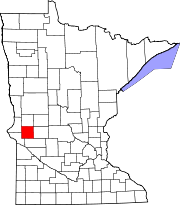 | |
| Townships | ||