
Mayflower, Arkansas
Mayflower, Arkansas | |
|---|---|
 Location of Mayflower in Faulkner County, Arkansas. | |
| Coordinates: 34°58′5″N 92°25′11″W / 34.96806°N 92.41972°W | |
| Country | United States |
| State | Arkansas |
| County | Faulkner |
| Government | |
| • Mayor | Danny Hester[1] |
| Area | |
| • City | 4.05 sq mi (10.50 km2) |
| • Land | 3.94 sq mi (10.20 km2) |
| • Water | 0.12 sq mi (0.30 km2) |
| Elevation | 282 ft (86 m) |
| Population (2020) | |
| • City | 1,984 |
| • Density | 503.55/sq mi (194.44/km2) |
| • Metro | 748,031 |
| Time zone | UTC-6 (Central (CST)) |
| • Summer (DST) | UTC-5 (CDT) |
| ZIP code | 72106 |
| Area code | 501 |
| FIPS code | 05-44750 |
| GNIS feature ID | 2405041[3] |
| Website | mayflowercity |
Mayflower is a city in Faulkner County, Arkansas, United States.[3] The population was 2,234 at the 2010 census,[4] up from 1,631 at the 2000 census. It is located in the Central Arkansas region.
History[edit]
Mayflower is a small town located along Interstate 40 southeast of Conway (Faulkner County) and northwest of Little Rock (Pulaski County). Located on the southwestern edge of Lake Conway, Mayflower is particularly known for its fishing. Like many of the smaller towns of Faulkner County, such as Vilonia and Greenbrier, Mayflower offers a rural lifestyle within a short drive of Conway and Little Rock, where many of its residents commute to work.[5] It was incorporated as a town in Arkansas on March 6, 1928.
The area’s earliest European settlers were Loyalists, known then as Tories, who moved westward in order to flee the Revolutionary War. Families such as the Flannagins and Massengills arrived around 1778 and settled near the mouth of Palarm Creek.[5] However, local tribes of Native Americans had inhabited this region for centuries, principally the Quapaw. Yet, other indigenous groups were in this area now known as part of the Great Plains Cultural Area.[6]
Like most of Arkansas, the land was heavily wooded and was therefore logged extensively until the turn of the twentieth century. Cotton plantations existed during the American Civil War owing to the river bottom’s fertile soil. This would later give way to sharecroppers and modern farming. This presents the largest source of the local economy today, although some small businesses exist in the town.[5]
The 2013 Mayflower oil spill occurred on March 29, 2013, when an ExxonMobil pipeline carrying heavy crude oil ruptured near Mayflower, spilling thousands of barrels of oil.[7] This caused the evacuation of 22 homes as well as extensive damage to other local properties and the local ecosystem.[5]
2014 tornado[edit]
Mayflower was hit by a violent EF4 tornado before 8:00 p.m. on April 27, 2014.[8]
Geography[edit]
Mayflower is located in southern Faulkner County at 34°58′5″N 92°25′11″W / 34.96806°N 92.41972°W (34.968118, -92.419603).[9] The Interstate 40/US 65 freeway passes along the eastern edge of the city, with access from Exit 135 (Arkansas Highway 89). I-40 leads southeast 20 miles (32 km) to Little Rock, the state capital, and north 10 miles (16 km) to Conway, the Faulkner County seat.
Mayflower has a total area of 4.0 square miles (10.4 km2), of which 4.0 square miles (10.3 km2) is land and 0.04 square miles (0.1 km2), or 1.18%, is water.[4]
Demographics[edit]
| Census | Pop. | Note | %± |
|---|---|---|---|
| 1930 | 188 | — | |
| 1940 | 165 | −12.2% | |
| 1950 | 293 | 77.6% | |
| 1960 | 355 | 21.2% | |
| 1970 | 469 | 32.1% | |
| 1980 | 1,381 | 194.5% | |
| 1990 | 1,415 | 2.5% | |
| 2000 | 1,631 | 15.3% | |
| 2010 | 2,234 | 37.0% | |
| 2020 | 1,984 | −11.2% | |
| U.S. Decennial Census[10] | |||
Mayflower is part of the Little Rock–North Little Rock–Conway Metropolitan Statistical Area.
2020 census[edit]
| Race | Number | Percentage |
|---|---|---|
| White (non-Hispanic) | 1,696 | 85.48% |
| Black or African American (non-Hispanic) | 122 | 6.15% |
| Native American | 9 | 0.45% |
| Asian | 6 | 0.3% |
| Pacific Islander | 1 | 0.05% |
| Other/Mixed | 111 | 5.59% |
| Hispanic or Latino | 39 | 1.97% |
As of the 2020 United States census, there were 1,984 people, 736 households, and 480 families residing in the city.
2000 census[edit]
As of the census[12] of 2000, there were 1,631 people, 740 households, and 500 families residing in the city. The population density was 556.8 inhabitants per square mile (215.0/km2). There were 872 housing units at an average density of 297.7 per square mile (114.9/km2). The racial makeup of the city was 95.16% White, 3.37% Black or African American, 0.31% Native American, 0.06% Asian, 0.25% from other races, and 0.86% from two or more races. 0.67% of the population were Hispanic or Latino of any race.
There were 740 households, out of which 20.7% had children under the age of 18 living with them, 53.8% were married couples living together, 10.0% had a female householder with no husband present, and 32.4% were non-families. 27.8% of all households were made up of individuals, and 11.6% had someone living alone who was 65 years of age or older. The average household size was 2.20 and the average family size was 2.66.
In the city, the population was spread out, with 17.5% under the age of 18, 7.2% from 18 to 24, 24.3% from 25 to 44, 30.9% from 45 to 64, and 20.1% who were 65 years of age or older. The median age was 46 years. For every 100 females, there were 92.6 males. For every 100 females age 18 and over, there were 93.0 males.
The median income for a household in the city was $35,469, and the median income for a family was $39,013. Males had a median income of $29,821 versus $23,102 for females. The per capita income for the city was $19,889. About 7.0% of families and 8.6% of the population were below the poverty line, including 9.1% of those under age 18 and 14.0% of those age 65 or over.
References[edit]
- ^ "Mayor of Mayflower Arkansas - City of Mayflower, Arkansas". cityofmayflower.com. Retrieved January 3, 2020.
- ^ "2020 U.S. Gazetteer Files". United States Census Bureau. Retrieved October 29, 2021.
- ^ a b c U.S. Geological Survey Geographic Names Information System: Mayflower, Arkansas
- ^ a b "Geographic Identifiers: 2010 Census Summary File 1 (G001): Mayflower city, Arkansas". American Factfinder. U.S. Census Bureau. Archived from the original on February 13, 2020. Retrieved April 18, 2016.
- ^ a b c d "Encyclopedia of Arkansas". Encyclopedia of Arkansas. Retrieved April 10, 2022.
- ^ Waldman, Carl (1985). Atlas of the North American Indian. New York, NY, USA: Facts on File, Inc. pp. 39–40.
- ^ Exxon cleans up Arkansas oil spill; Keystone plan assailed Reuters
- ^ "NWS Damage Survey for 04/27/2014 tornado event". National Weather Service Offic in Little Rock, Arkansas. Retrieved April 30, 2014.
- ^ "US Gazetteer files: 2010, 2000, and 1990". United States Census Bureau. February 12, 2011. Retrieved April 23, 2011.
- ^ "Census of Population and Housing". Census.gov. Retrieved June 4, 2015.
- ^ "Explore Census Data". data.census.gov. Retrieved December 31, 2021.
- ^ "U.S. Census website". United States Census Bureau. Retrieved January 31, 2008.
External links[edit]
Municipalities and communities of Faulkner County, Arkansas, United States | ||
|---|---|---|
| Cities | 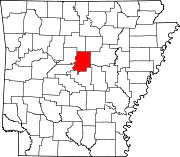 | |
| Towns | ||
| Unincorporated communities | ||
| Footnotes | ‡This populated place also has portions in an adjacent county or counties | |